The total length of the US–Mexican border is close to 2,000 miles, from the Pacific Ocean to the Gulf of Mexico. Heading east from Tijuana and San Diego are the vast expanses of Sonora and Chihuahua deserts, via Ciudad Juárez and El Paso, before reaching the Colorado river delta, and finally the cities of Matamoros and Brownsville.
Jim Watson drove nearly 1,750 miles along dirt roads, through deserts and vast amounts of farm lands along the US side of the border beginning in San Diego, California and ending in San Antonio, Texas. Watson’s Mexican colleagues Yuri Cortes, and Guillermo Arias took a parallel journey on the Mexican side, beginning in Baha California and finishing in Tamaulipas.
I felt that many Americans had no idea what the border in the US really looked like, and I myself had no complete vision of it. I hoped US Border Patrol public affairs would be able to provide me with embeds along the the way, but the best they could do was let the agents in the areas know I was coming and that I could be there shooting pictures; Jim Watson
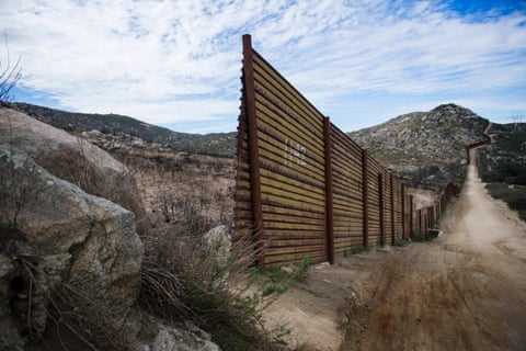
Watson continues: “I quickly began to see, once starting the project, that there is already a wall. While it is not brick and mortar, a huge fence runs up and down the border in quite a few locations. That being said, there are gaps in the fence, and there are areas where there is nothing at all. In many locations the border is the river, or mountains, and a physical barrier would almost be nonsensical, but there are places that the border patrol mentioned that are now seeing high traffic because the fence is everywhere else.
“It seems to me that the fence is not really needed to keep out illegal immigrants, they come to the US mainly by overstaying their visas. I would think the fence is important in the eyes of the border patrol for keeping out the drugs. The barrier slows down the contraband crossing the borders and also funnels it into locations the border patrol can reinforce their presence.”
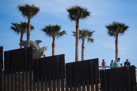
Tijuana–San Diego
This journey begins in Tijuana, in the Mexican state of Baja California, and in San Diego, in southern California. The San Diego–Tijuana conurbation is the second-largest trans-border agglomeration between the US and a bordering country after Detroit and Windsor on the US/Canadian border, with a combined population of almost 5 million people.
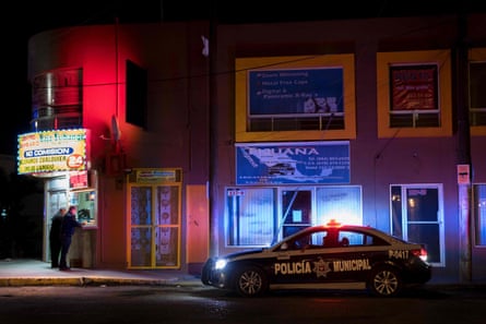
- Municipal police patrol the area by a money exchange near the border in Tijuana
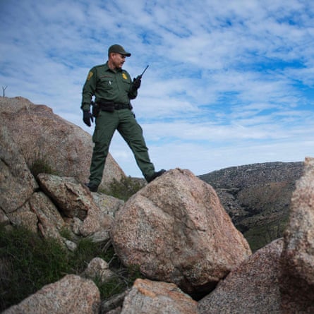
I spent time hiking the trails in Tecate with border agent Luis Barona, and was amazed that we have seismic tools that are triggered by someone walking around in the area. While talking he got a call and we had to go investigate – turned out to be an animal, which is quite common; Jim Watson
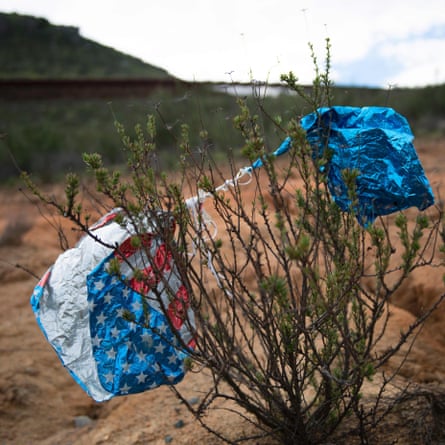
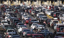
It is estimated that the two border crossing stations between the cities of San Diego and Tijuana account for up to 300,000 border crossings each day.

- A stream of tail lights illuminate the road as cars cross the border into Mexico
It is fair to say that the Tijuana–San Diego border is one of the more monitored urban spots along the border. In some points you can find up to three fences and/or barriers; Guillermo Arias
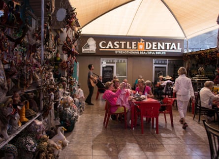
- Visitors from the United States sit near a souvenir stand and dental clinic in Los Algodones, Mexico.
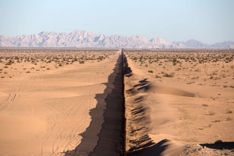
Deserted border
West of the twinned towns of San Luis Río Colorado, and San Luis Arizona, lie huge expanses of national park. The El Pinacate y Gran Desierto de Altar Biosphere Reserve, a Unesco world heritage site, lies south of the border, with the Cabeza Prieta National Wildlife Refuge, and the Organ Pipe Cactus National Monument to the north.
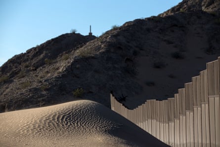
- A section of the border fence at San Luis Río Colorado, Sonora
The Imperial dunes are amazing desert structures from the wind, with a monstrous border fence cutting straight through their beauty. It seemed like endless desert during that period with only the fence to break it up with its contrast, Jim Watson
Temporary agricultural workers cross the border at San Luis for work, some having to be across the border and in line by 4am for a day’s work on the lettuce farmswhere they work for $10 an hour for ten hours a day.
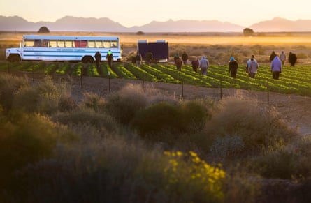
- Temporary agricultural workers walk through farm land in the early morning in Weldon, Arizona
The workers are given the option of a daily $40 advance from the $100, with the rest in a paycheck at the end of the week.
Everyone looked very tired and weather burnt, and said it was a hard day but still managed to smile and joke with their peers. They then walked a half mile back to the port of entry and to their homes in Mexico only to be back again nine or so hours later; Jim Watson
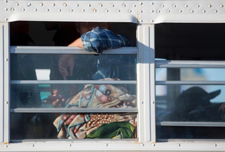

Organ Pipe Cactus National Monument is a nature preserve with thousands of cacti covering the grounds. It was truly an amazing sight, though I didn’t get to talk to a single soul all day; Jim Watson


- Cacti on the Mexican side of the border fence at Organ Pipe Cactus National Monument

Nogales
Nogales in the US borders its namesake in Sonora state, Mexico, and is Arizona’s largest international border community. The border stretches through both towns. Nogales in Mexico is both a gateway to the US and a place of return for deported migrants.
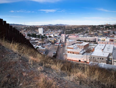
- The border fence stretching through Nogales
The border in Nogales is a full-on big fence, with slates to see the other side but tall enough to make climbing it very hard. The town itself was very striking in that it was seated right up to the border and seemed to have a fairly interactive life with its Mexico counterpart. Outside of town there were some rolling hills that made for good pictures as the border fence almost looked like the spin of a serpent going up and down with the landscape; Jim Watson

- A US Border Patrol agent parks on a hill top near the border fence in Nogales, Arizona
I have mixed feelings ... I feel angry against my own country sometimes. In Nogales I was followed by narco vehicles, and they sent me a kind of message to leave the area. I felt more secure on the US border than in Mexico, with the US police, and I did not feel safe with the Mexican federal police, which is incredible and sad, how is it possible? I decided to work very slowly in Nogales and to drive through the US and only cross back to Mexico to work on the project; Guillermo Arias
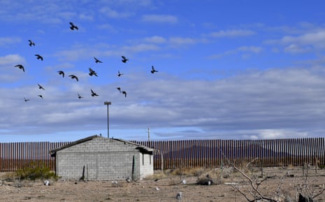
Puerto Palomas–Columbus
Puerto Palomas is an alternative border crossing 90 minutes west of El Paso. US tourists come here to purchase low-cost prescription drugs, get dental work done, or buy Mexican arts and crafts from Chihuahua. Columbus, in New Mexico was the site of an attack in 1916 by Mexican revolutionary leader Pancho Villa.

- The sun begins to rise on country road B002 outside Columbus, New Mexico
I met up with Yuri and Gillermo in Columbus and we took a picture of them on one side and me on the other where the fence went from 10ft high to just waist level again. I could reach across and hug everyone and shake hands. US Border Patrol drove by as we did so and didn’t even stop; Jim Watson
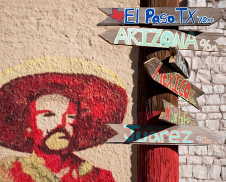
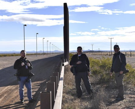
- Signs show distances to different cities by a mural of Pancho Villa in Columbus. Photographers Jim Watson, Yuri Cortez and Guillermo Arias at the border fence in Puerto Palomas
Ciudad Juárez–El Paso
The Texan town of El Paso meets Ciudad Juárez in Chihuahua state on the Mexican side. El Paso used to be part of Mexico and 80% of residents are of Latino origin. Juárez, as locals call it, has become notorious for violence and a centre for drug trafficking controlled by the Juárez cartel.
The two cities, along with Las Cruces (in the neighboring state of New Mexico), form a combined international metropolitan area, sometimes called the Paso del Norte or El Paso–Juárez–Las Cruces, and is the second largest bi-national urban area on the US-Mexican border, with a combined population of over 2.5 million.
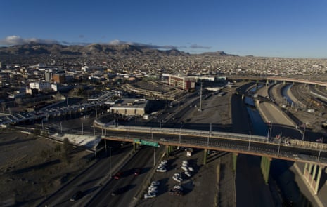
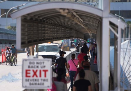
The border between Ciudad Juárez and El Paso is perhaps one of the most active frontiers, the transit of the car to the checkpoint took us more than an hour and a half. It is a border marked by the different levels of poverty in the Mexican neighbourhoods and the neighbourhoods of El Paso. We had the opportunity to use a drone to show the contrast between both cities; Guillermo Arias

- Crossing the footbridge from El Paso to Juárez. Right: Roadside shops near the port of entry in El Paso. A shoe lies abandoned by the metal border fence in Puerto Anapra, Juárez.
There are four international ports of entry connecting Juárez and El Paso, including the Bridge of the Americas, Ysleta international bridge, Paso del Norte bridge and Stanton Street bridge.

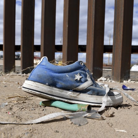
The border in El Paso is monstrous. You can’t really get near it in so many places, there is no parking and the Rio Grande river plays into the border as well. The fence itself was crazy, it looked like Mexico was in jail. No lie, the fence look intimidating and was very in-your-face; Jim Watson

Ojinaga–Presidio
The Rio Grande, or as it is known in Mexico the Rio Bravo del Norte, begins in south-central Colorado in the US and flows to the Gulf of Mexico. The river forms a natural border beginning at Ciudad Juárez/El Paso and stretching east, between Texas in the north and the Mexican states of Chihuahua, Coahuila and Nuevo León to the south.
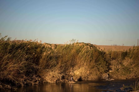
The most dramatic moment I experienced happened when I saw a woman carrying a baby and throwing herself into the Rio Bravo to cross illegally. Under the cover of the sunset and measuring each step inside the river, the woman crossed very slowly. It seemed that she carried lead on her feet and clung to her small baby. One false step and she could have lost her baby or both could have been dragged away by the water. However, she achieved her goal and was soon lost in the undergrowth of long-awaited American soil; Yuri Cortez

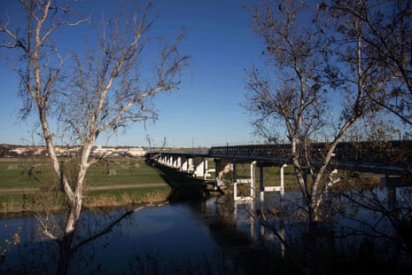
International bridges
With the border now formed naturally by the widening river, the main crossing points are international bridges with checkpoints at each end. The Texan town of Del Rio crosses over the river to Ciudad Acuña in Mexico, and further east the bridge at Piedras Negras crosses over to the Texan town of Eagle Pass.
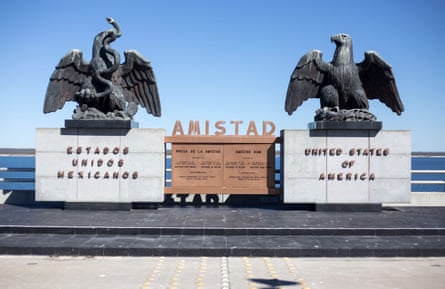
- Sculptures on the international boundary at Amistad reservoir on the US/Mexico border near Ciudad Acuña.
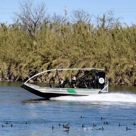
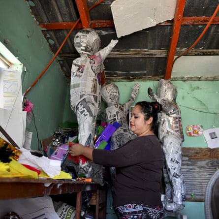
- US border patrol agents on the Rio Bravo in the border city of Ciudad Acuña; Julia Garcia works making piñatas to sell in Ciudad Acuña

The border towns of Laredo in Texas and Nuevo Laredo on the Mexican side are on the road heading north towards the large Texan city of San Antonio.
This story for me, as an American, was difficult at times. You want and think you need proper border security for your nation, yet you also feel that everyone deserves a chance at prosperity; Jim Watson
Watson continues: “I think many people can easily assume this is an American news story, but the effects of this can also be felt on the other side of the border. While many of the people I met along the way were adamant that a border fence or wall was needed, they also complained that that was not the real issue at hand. We already have a wall, they would say, it is the concerns about immigration that US President Donald Trump is putting on the country that is hurting things.
“Business owner would say to me that sales are down because fewer people are coming across the border now. People are scared of being deported and that means they are not leaving their homes. It is the immigration process itself that needs to be repaired, they would say.”

